Bramor ppX
Bramor ppX

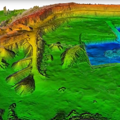
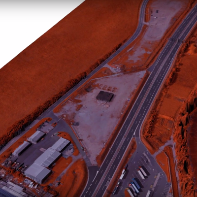
The BRAMOR ppX (GNSS PPK - Post Processing Kinematic) UAS is ideally suited for surveying and remote sensing applications that need a fast high precision set of results, down to sub-centimeter GSD level also in the absence of a grid of ground control points.
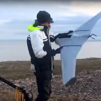
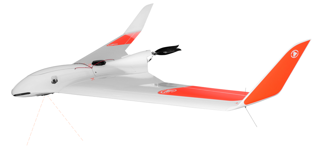
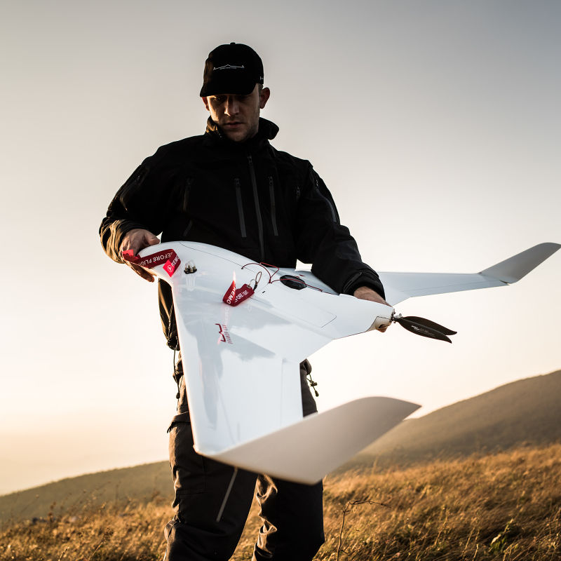
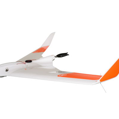
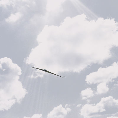
The industry leading unmanned aircraft systems are electrically powered and able to achieve superior stability and endurance through unique advanced Blended Wing Body airframe aerodynamics.
Downloads
Product Catalogue Q3-2018
(PDF, 7.52 MB)Bramor ppX Accuracy Whitepaper
(PDF, 377.47 kB)Bramor gEO Accuracy Whitepaper
(PDF, 870.57 kB)Area Coverage Chart
(PDF, 210.88 kB)Bramor ppX - FCC Certificate of Conformity
(PDF, 314.24 kB)SX101 GCS - FCC Certificate of Conformity
(PDF, 1.69 MB)BRAMOR ppX delivers a staggering 3,5 hours of flight endurance - more than double of most other UAVs
Efficiency, Stability, Modularity and system flexibility are the key features of the C-ASTRAL BRAMOR UAS family.
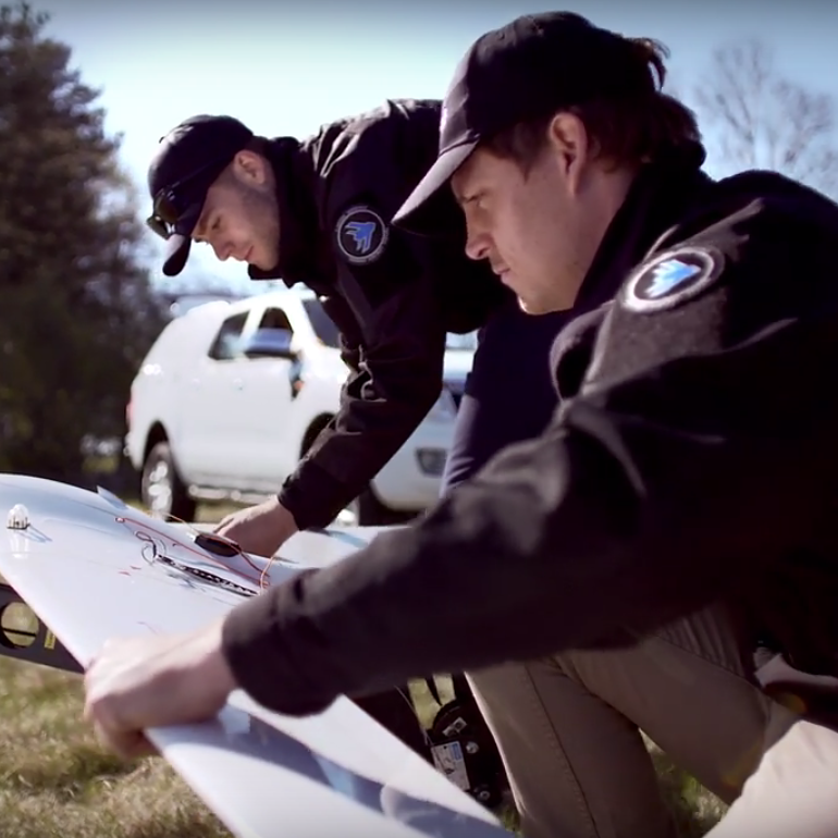
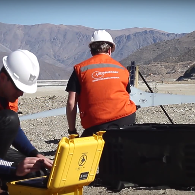
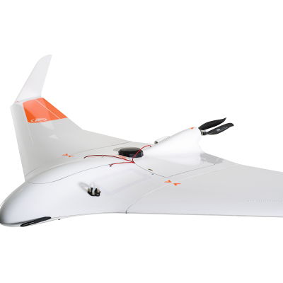
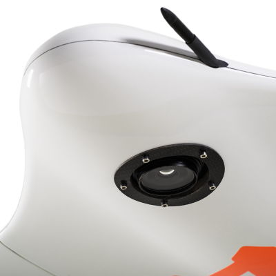
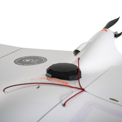
The system is comprised of an air and ground segment, consisting of a state of the art GNSS on board receiver and ground base station, the BRAMOR ppX blended wing body modular airframe with a lot of sensor options, a portable and ergonomic rugged ground control station and catapult launcher. The BRAMOR ppX UAS combines high precision autonomous operations with data acquisition, turbulent air penetration and stability with long endurance. Optional enhancements such as high precision IMU and tracking antennas are available.
The BRAMOR ppX is the ultimate high productivity tool for global surveying and remote sensing in very remote and less remote areas, with an industry-leading endurance of 3,5 hours, an operational ceiling of 5000m AGL and capable of operating in winds of up to 60km/h. Unrivalled. The airframe is made of advanced composite materials (Kevlar/Carbon/Vectran) that provide a high level of survivability. A high visibility colour scheme, strobe and NAV lights are optional. Embedded autonomous flight procedures include an array of fail-safe options based on man-rated standards. It is equipped with C-Astral high rate GNSS receiver and IMU precision data-logging electronics.
COMPATIBLE WITH IMAGE PROCESSING SOFTWARE:
![]()
![]()
![]()
And others: EnsoMOSAIC, Menci
* Flight endurance measured at ICAO standard atmosphere conditions (15 °C / 1013,25 hPa / winds calm), depends on UAS configuration/system weight.
** Product images are for illustrative purposes and may differ from the actual product.
BRAMOR ppX airframe:
• Survey grade GNSS L1/L2 receiver
• Digital IP link
• 24.2 MP RGB Sensor
GCS:
• SX 202 WiFi communication unit
• 11,6" Rugged tablet with sunlight readable screen (MIL-STD-810G / IP65)
• Digital IP link
• C3P flight control software
Launcher:
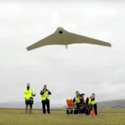
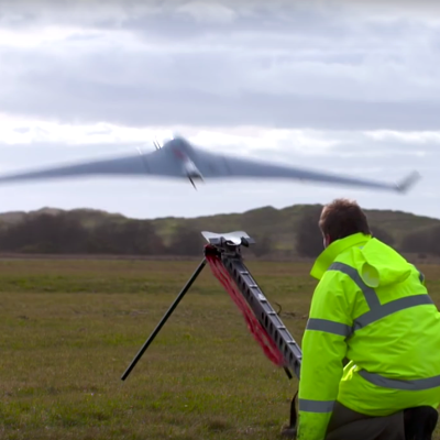
• CAT 1 foldable elastic launching system
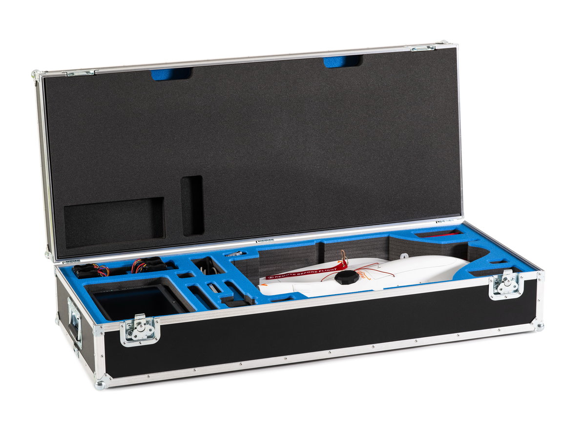
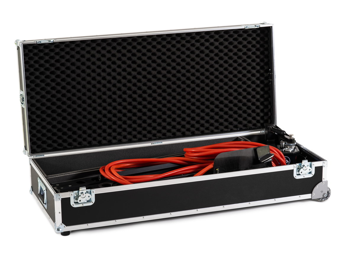
Transportation:
• Flight case transportation system (2x)
Other:
• Recovery parachute with a protective pack (2x)
• Set of basic spares
• Battery charger
• Training at C-Astral (excluding lodging & transportation costs)
• Documentation & Manuals
Note: Bramor ppX is also available with a standard GPS receiver.
Airframe
| Wingspan | 230 cm |
| Platform length | 96 cm |
| Center module length | 67 cm |
| Engine | Brushless Electric |
| Onboard power | Li-Po |
| Takeoff weight | 4,7 kg |
Flight
| Cruise speed | 16 m/s |
| Max speed | 22 m/s |
| Landing | Parachute |
| Endurance | Up to 3,5h |
| Service ceiling | Up to 5000 m AMSL |
| C&C RF | 869.4 - 869.65 MHz or 902 - 928 MHz or 2.4 GHz and Options |
| C&C range | Up to 40 km |
| Navigation lights | Optional |
| Convoy following | Optional |
| Take-off | Catapult |
| Navigation | Autonomous / waypoints array |
| Failsafes | User-Pre-program |
Transportation
| Case #1 | 122 x 52 x 28 cm, 23 kg (standard package), Inter-lockable with catapult case |
| Case #2 | 122 x 52 x 28 cm, 23 kg (standard package), Wheels for single man transportation |
| Options | Mil Spec Bramor Backpacks |
For more information
about the system
Have a question?
Gallery
Video