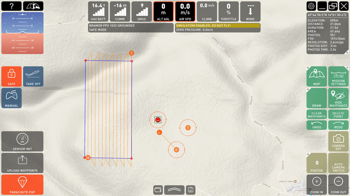
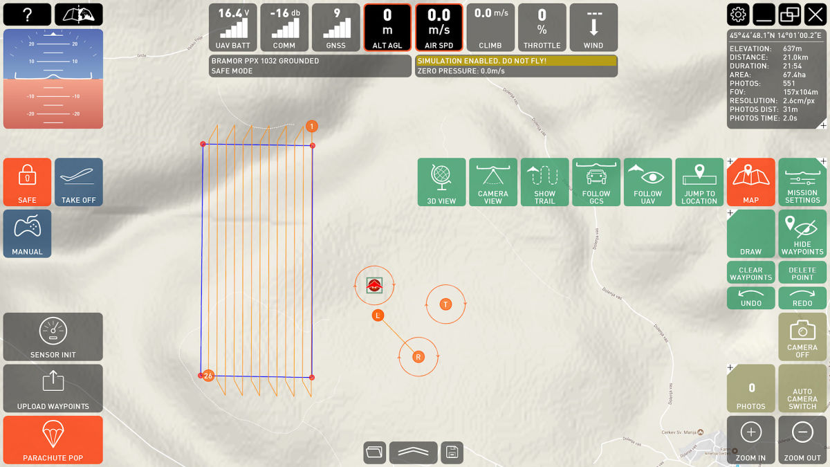
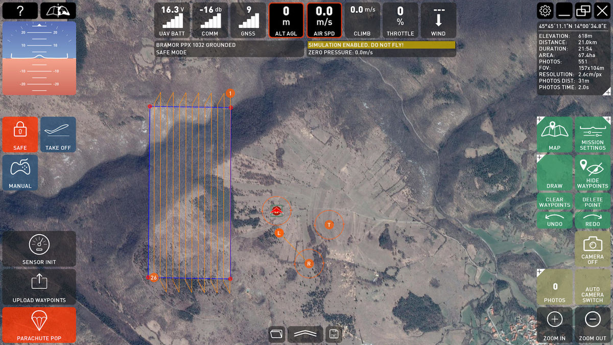
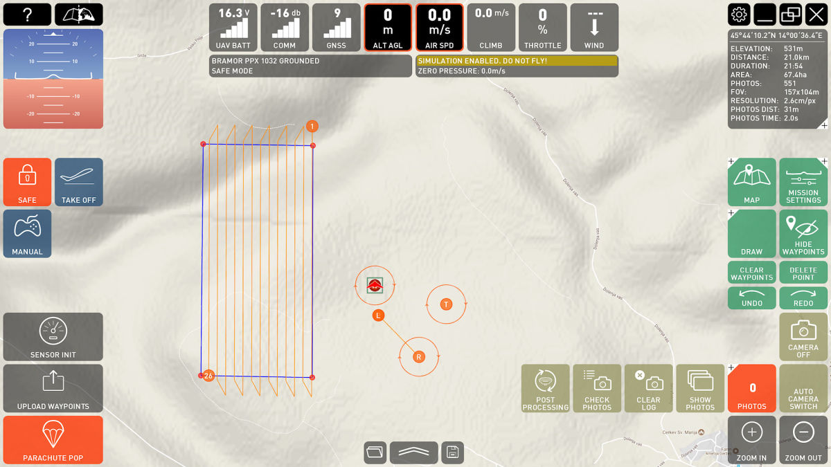
C³P command, control, communications and planning software provides superior situational awareness and safety of UAS operations through a user-friendly GUI and intuitive control.
With the C-ASTRAL C³P (Command, Communications, Control and Planning) software you can plan and execute your UAV flight missions, control the flight parameters and sensors in real time and collect and aggregate geospatial data.
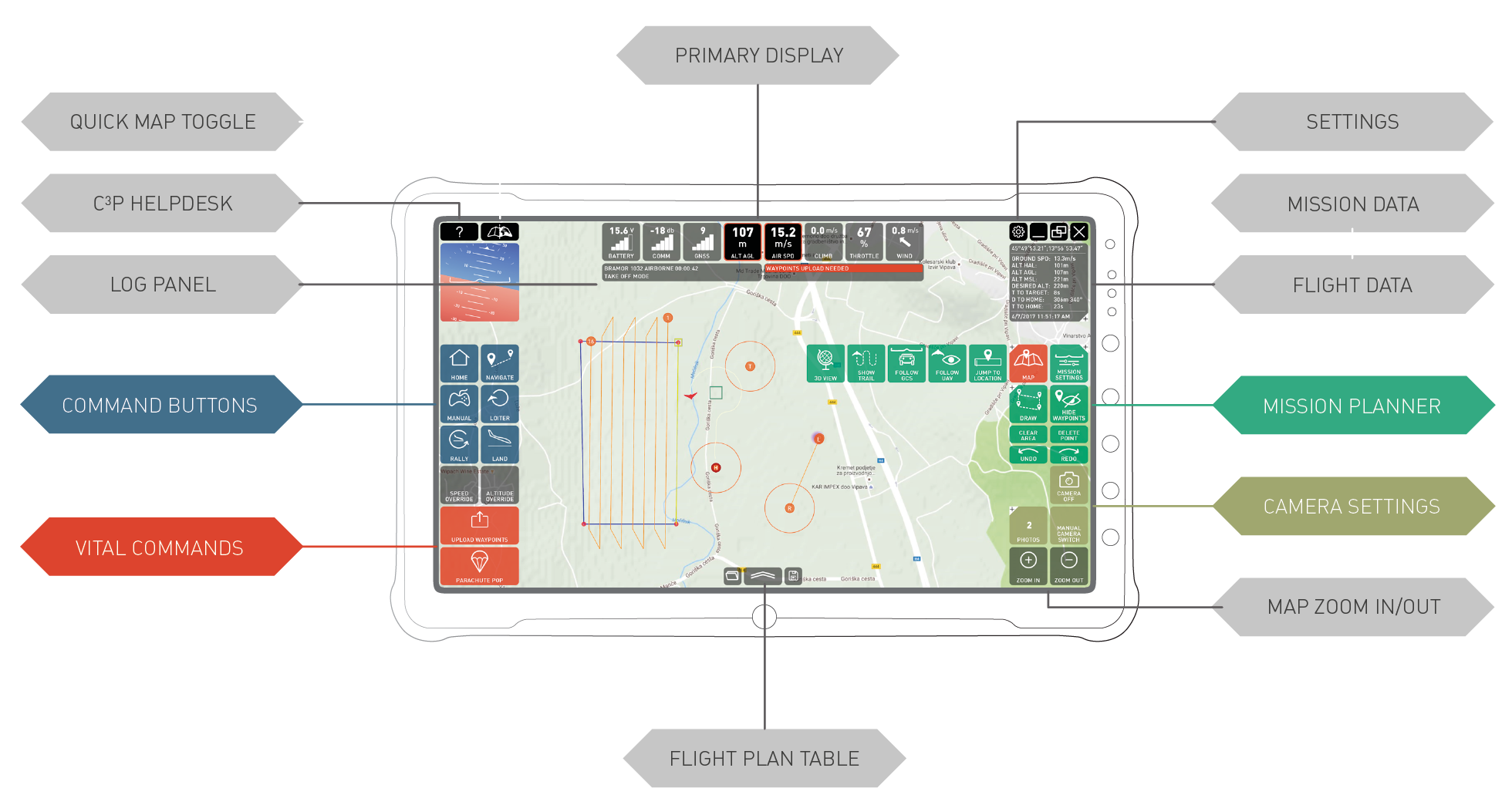
Ergonomics for situational awareness, safety, ease of use, easily readable flight data and real-time flight control were the primary considerations when we started developing this software suite.
C³P has been developed with extensive input from some of the most experienced C-ASTRAL systems pilots and users around the world and has now completely replaced previous mission planning and command software solutions.
The C³P is hardware agnostic and its modular support approach enables the integration of new sensors and solutions as they will become market ready.
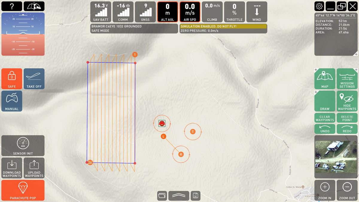
C3P ppX MODE
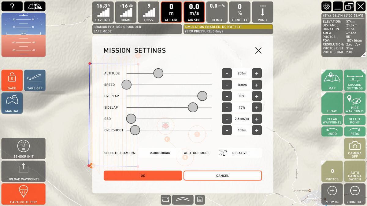
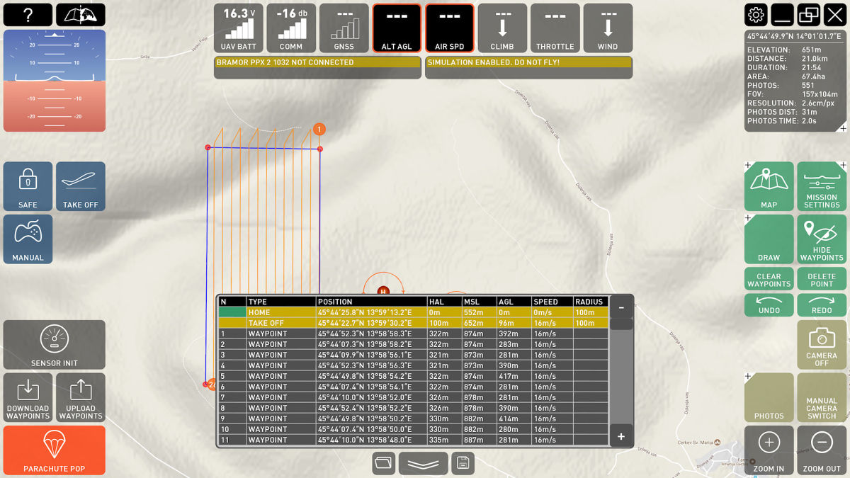
- Multi-geometry ad-hoc mission planning
- Transect planning
- Polygon planning
- Corridor planning
- Quick access to critical flight control commands
- Constant image acquisition quality monitoring
- Altitude mode flying
- Loiter mode flying
- Flight data display
- Failsafe controls
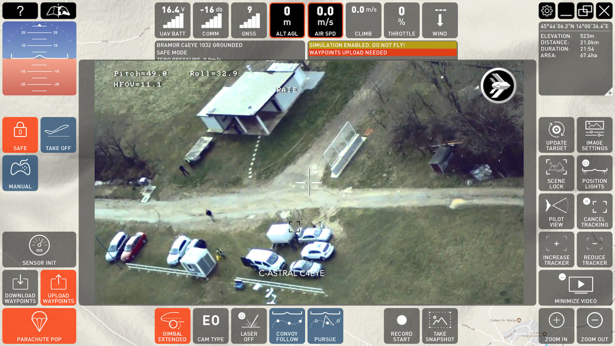
C3P C4EYE MODE
- Pre-planned or live control flight modes
- Quick access to critical flight control commands
- Target tracking
- Convoy following
- Sensor data and still image recording
- Flight data display
- Failsafe controls
- Altitude mode flying
- Loiter mode flying
- Target centric flying